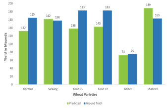
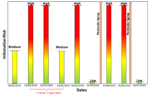
AI-powered platform combines drone, satellite, and IoT data to deliver actionable insights that boost yields, optimize resources, and enhance crop management.
CROP-AI VISION
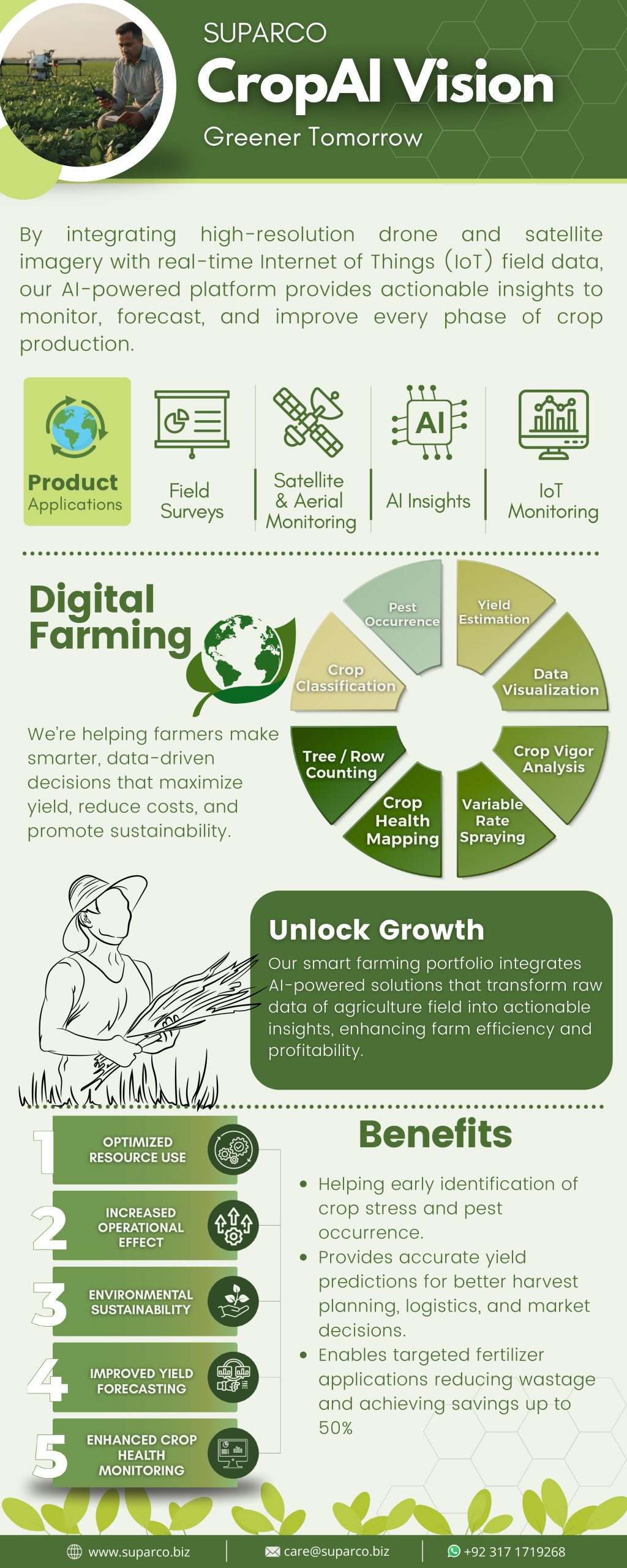
Field Surveys
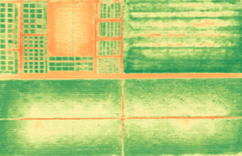
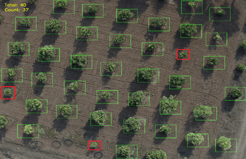
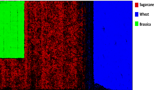
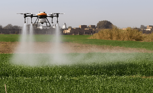
Our precision agriculture process begins with conducting a comprehensive aerial and ground surveys of agricultural fields using advanced drone platforms. These surveys capture high-resolution RGB and multispectral imagery, providing a complete visual and spatial overview of the agriculture land.
Internet of Things (IoT)
To complement the aerial data, we have installed IoT nodes across the agriculture field to continuously monitor soil and weather parameters such as moisture, temperature, humidity, and nutrient levels. This ground-level data enhances the accuracy and contextual understanding of crop conditions.
Aerial Data Products
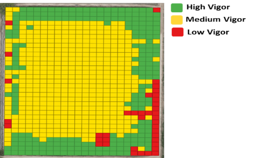
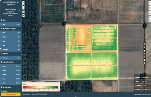
The captured aerial data has been processed to generate specialized geospatial products that form the foundation for AI-based agricultural insights. In addition to drone-based surveys, satellite imagery is also utilized to provide wide-scale monitoring of agricultural fields.
By seamlessly integrating satellite, drone, and IoT data, our system ensures comprehensive, multi-source precision and reliability.