With our dynamic SATCOM Solutions, SUPARCO provides end to end secure communication solutions for Communication On The Move (COTM)and Communication On The Pause (COTP). SUPARCO has also recently introduced indigenous Regional Navigation Solutions to provide precise Position, Navigation and Timing (PNT) services.
Ssdls
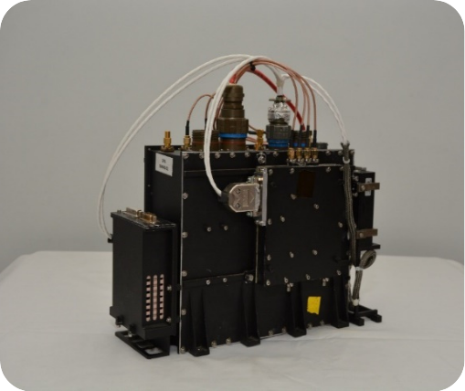
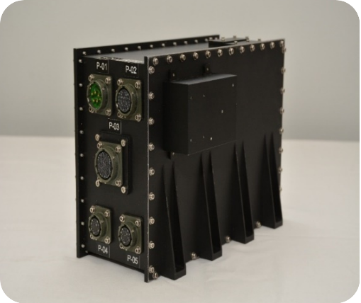
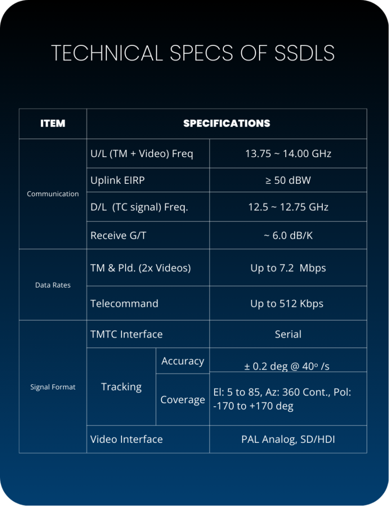
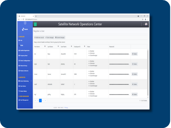
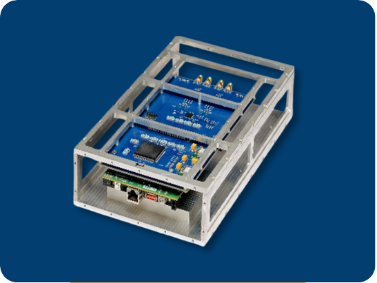
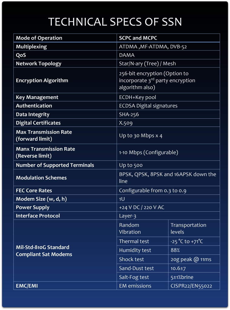
Smart Satellite Data Link System - SSDLS
SUPARCO indigenously designed and developed Smart Satellite Data Link Systems (SSDLS) for ‘Communication on the Move”. It can provide reliable and secure communication to airborne, ground and sea based platforms via our communication satellite: PAKSAT-1R. The terminals can be located anywhere with Ku-band coverage of triple play communication services including data, video and voice.
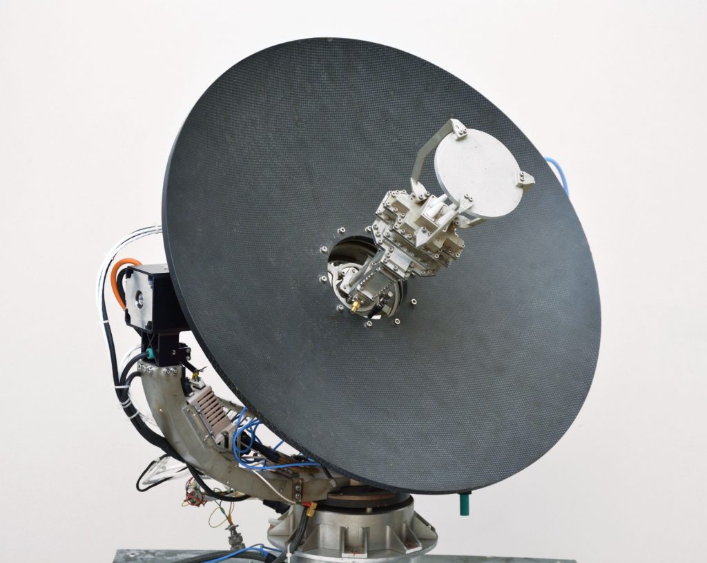
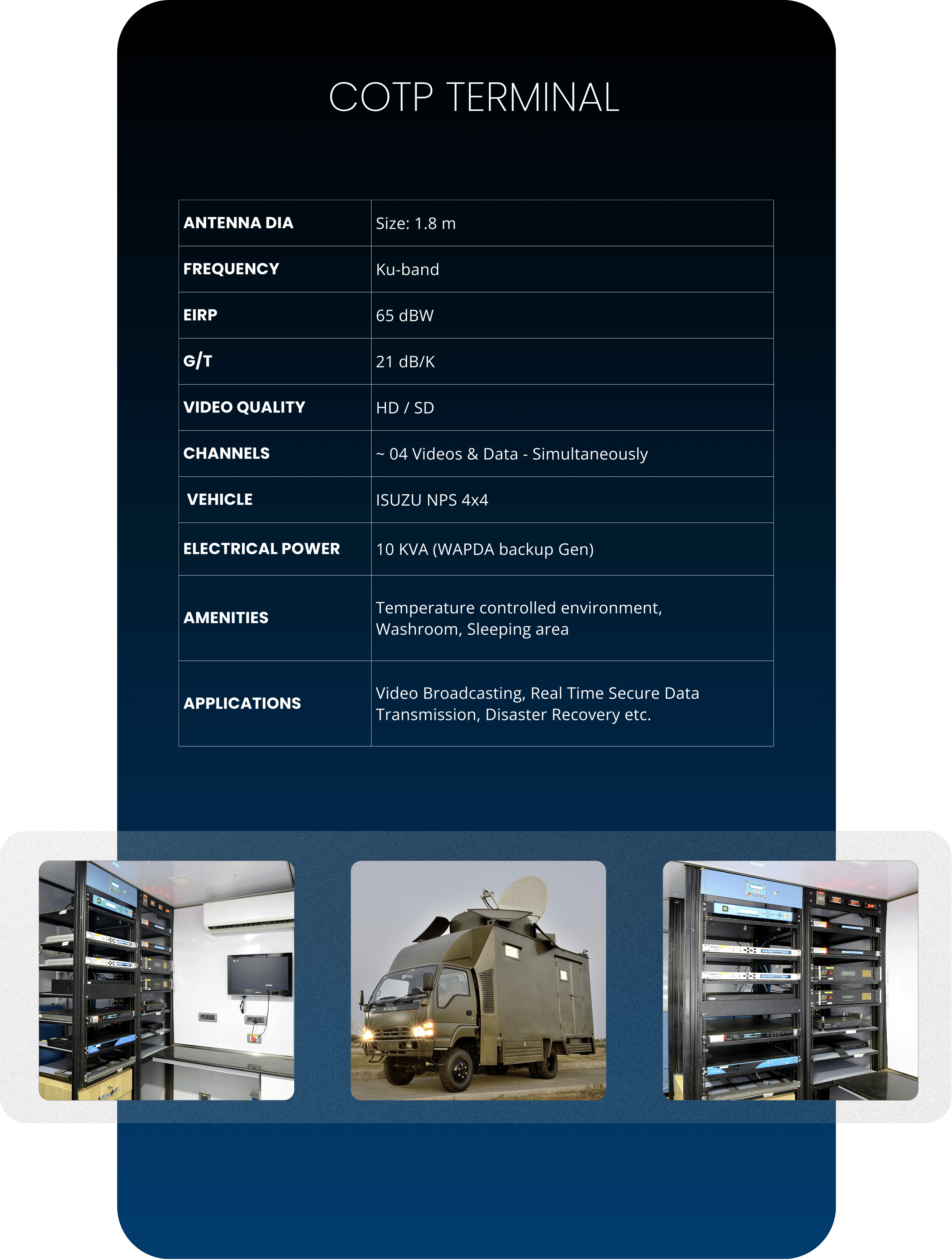
COMMUNICATION ON THE PAUSE VIA GEO-SAT (COTP-TERMINAL)
The basic principle behind COT-P is that a satellite antenna (along with associated equipment) is mounted on a vehicle. The antenna/equipment is not operative while vehicle is on move. The antenna is deployed and pointed towards the intended satellite after the vehicle has stopped / paused, to establish communication with the satellite. COTP systems are typically used for both goverment and commercial applications where medium to high data rate on-the-pause communications is required on very short notice, usually for short time duration.
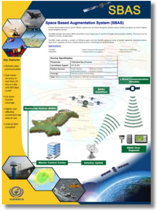
Pak-SBAS enables Public and Authorized Service to meet the 2.5m to 15cm positioning accuracy requirement thru provisioning of GPS & BDS correction signals inside & outside Pakistan.
Pakistan has developed its own Space Based Augmentation System named as ‘Pakistan Space Based Augmentation System (Pak-SBAS)’ for improving the accuracy and reliability of existing Positioning, Navigation, and Timing (PNT) service .
The Pak-SBAS is developed by SUPARCO in collaboration with the Pakistan Civil Aviation Authority (PCAA), with special permission from GPS and Beidou navigation system
SUPARCO as National Space Agency of Pakistan is responsible for development and operation of Pak-SBAS whereas PCAA is supporting SUPARCO in the implementation of the Pak-SBAS to meet the Performance Based Navigation (PBN) requirements of commercial aviation as per guidelines of International Civil Aviation Organization (ICAO) in Pakistan.
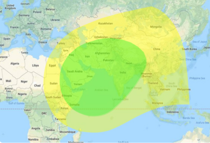
Within the very wide coverage of PakSAT-MM1 across the nation, including Arabian Sea as well, our valuable users can enjoy high precision Positioning, Navigation and Timing signals in both Static and Dynamic conditions.
Applications
Aviation
Marine
Railway
Intelligent transportation
Precise GIS
Precision Agriculture
Precision Mining
Deep Sea exploration
Smart City management
Urban Planning
Disaster Management
Precise UAV/UGV Navigation
Potential Clients
Location based services
Civil engineering and Urban planning (consultancy services)
Facility management
Survey and mapping industry especially Survey of Pakistan
Precision agriculture
GIS and mapping
Fleet management
Route planning especially in the inaccessible areas
Vehicle tracking companies
AI-based augmentation
Ground Based Augmentation System – GBAS
Pakistan has developed its own Ground Based Augmentation System named as ‘Pakistan Ground Based Augmentation System (Pak-GBAS)’ for improving the accuracy and reliability of existing Positioning, Navigation, and Timing (PNT) service cis & trans frontier.The Pak-GBAS is developed by SUPARCO in collaboration with the Pakistan Civil Aviation Authority (PCAA), with special permission from GPS and Beidou navigation system.
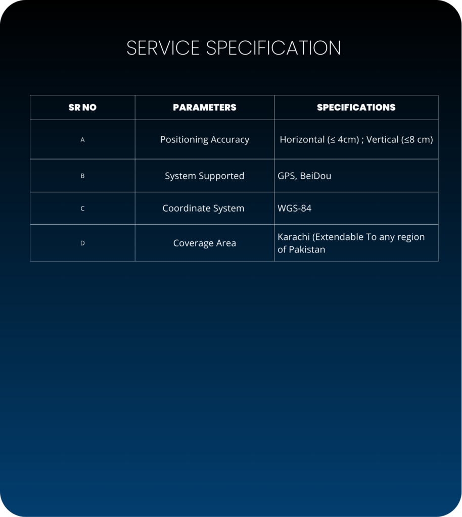
SUPARCO has achieved Initial Operational Capability of Pak-GBAS utilizing Network Real-Time Kinematic (NRTK) technology to enable real-time cm-level positioning through provision of correction signals to authorized users in Karachi. The Pak-GBAS service is extendable to any region of interest across Pakistan on requirement basis subject to availability of GSM/3G/4G data communication services.
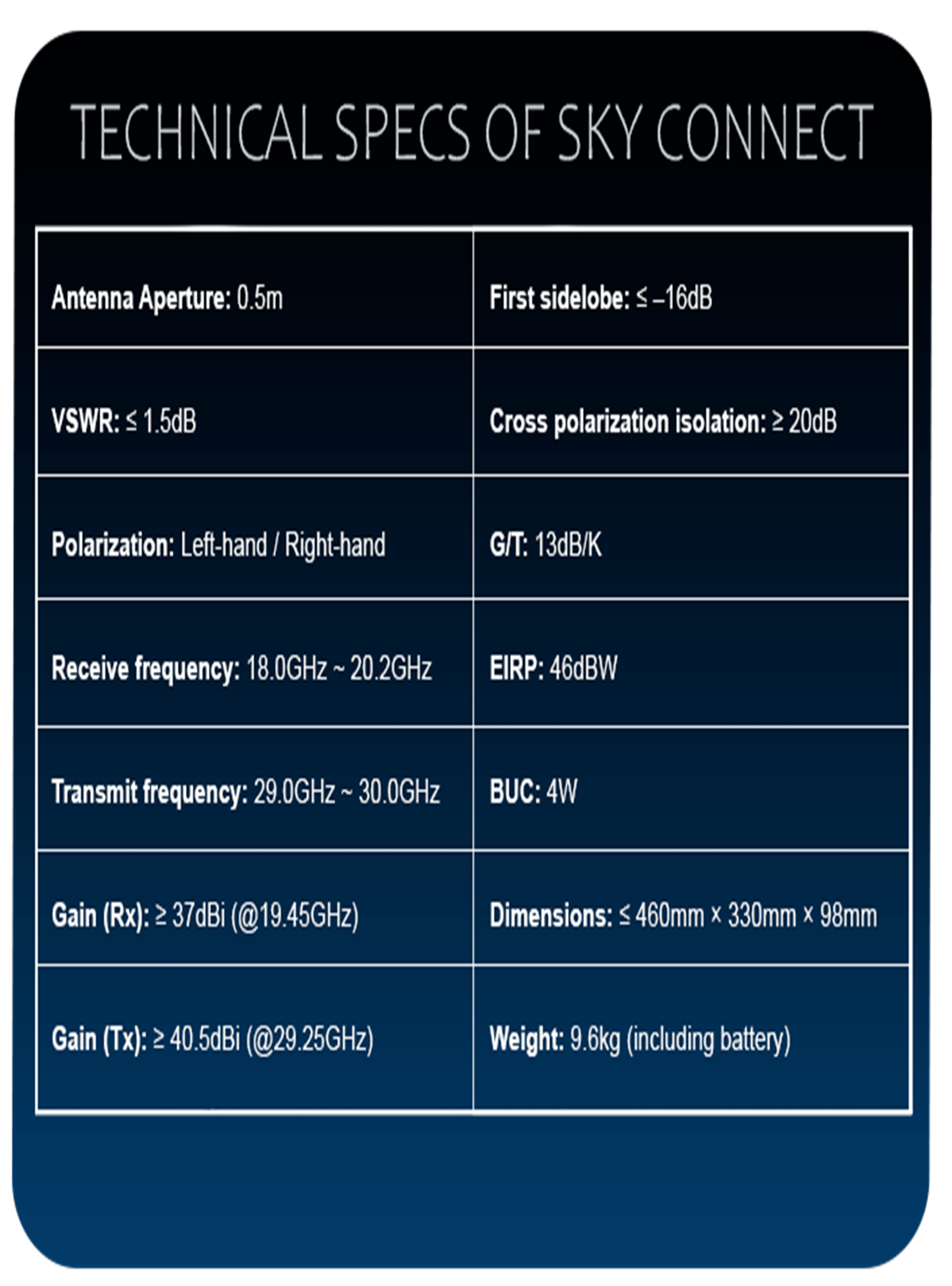
The Sky Connect satellite communication terminal is designed for Paksat-MM1 High-throughput Satellite, providing broadband satellite network access without geographical limitations. It features a compact and lightweight design with a high level of integration. With one-touch automatic satellite pointing and network access, it enables fast network deployment in various challenging environments.