Introduction
In 2019, Pakistan faced one of its worst locust invasions in decades—an agricultural crisis that threatened food security and livelihoods across the country. Amidst growing concerns and national emergency declarations, a key player emerged from above—SUPARCO, Pakistan’s national space agency. By harnessing the power of satellite technology, SUPARCO provided critical insights that helped the government contain the outbreak efficiently and sustainably.
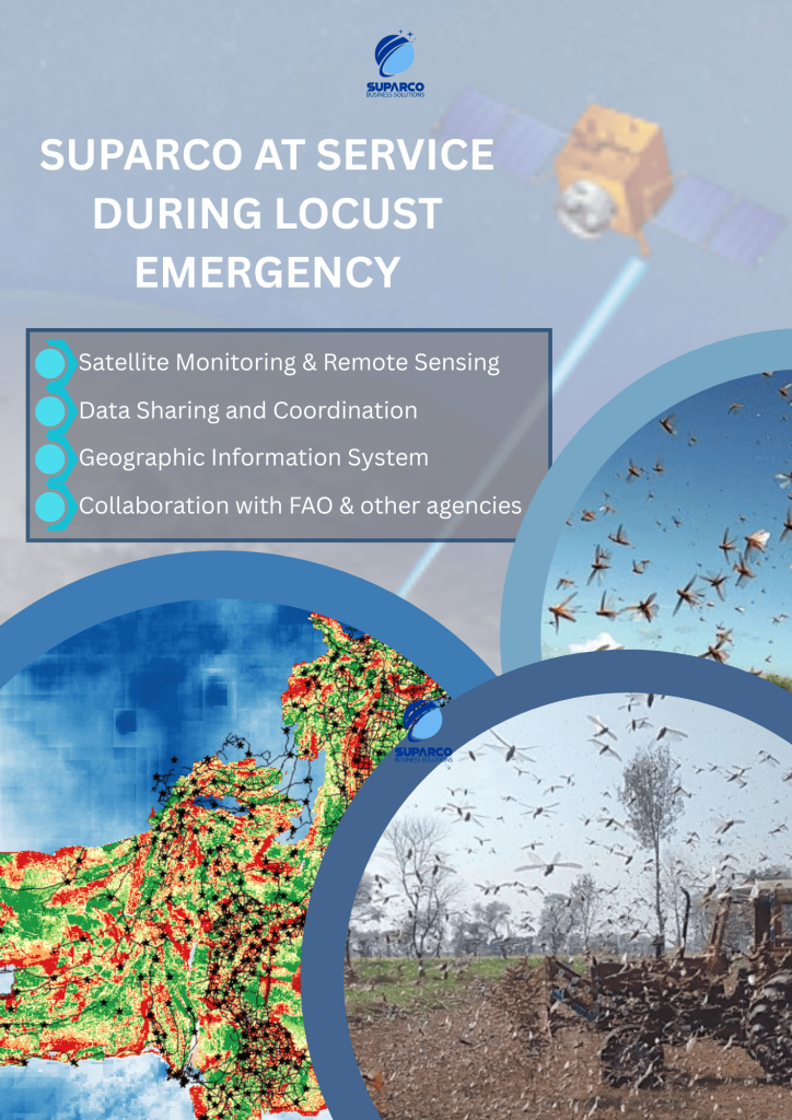
SUPARCO’s Strategic Role in Locust Control
SUPARCO’s collaboration with the National Locust Control Centre (NLCC) marked a turning point in the nation’s response. Through high-resolution satellite-based habitat mapping and remote sensing analytics, SUPARCO monitored potential breeding and infestation zones across 62 districts of Pakistan.
Rather than blanket pesticide spraying—which is costly, environmentally harmful, and often inefficient—SUPARCO’s data enabled authorities to target high-risk areas. This focused approach significantly reduced the use of chemicals and contributed to large-scale public savings.
SACRED: The Tech Behind the Response
At the heart of SUPARCO’s intervention was SACRED—the Space Application Centre for Response in Emergency and Disasters. As a UN-SPIDER Regional Support Office, SACRED employed cutting-edge satellite remote sensing to assess locust habitat suitability.
Using parameters like:
-
Vegetation cover
-
Soil type
-
Moisture content
SUPARCO developed dynamic maps that categorized areas into five levels of suitability: least, less, normal, moderate, and most prone to locust breeding. These maps were made available via the DisasterWatch Desert Locust Situation Alert geoviewer, empowering both authorities and field teams with real-time decision-making tools.
Tangible Impacts and Cost Savings
By integrating satellite data with ground surveillance, SUPARCO enabled:
-
Rapid identification of breeding zones
-
Early containment of swarms
-
Reduced pesticide use
-
Lower environmental damage
-
Millions saved in economic losses
The precise targeting of interventions made a measurable difference, protecting crops, minimizing ecological harm, and supporting food security for vulnerable communities.
Future-Ready: Scaling Satellite-Based Agricultural Defense
As climate variability increases the risk of agricultural threats, SUPARCO’s model sets a precedent for proactive, technology-driven responses. Looking ahead, the space agency aims to enhance national resilience with satellite-enabled services, including:
-
🌱 Vegetation and Soil Monitoring: Detecting conditions conducive to locust breeding
-
⚠️ Early Warning Systems: Alerting farmers and authorities before outbreaks
-
📊 Damage Assessment Tools: Supporting recovery through post-invasion analysis
-
📍 Resource Optimization: Directing control measures where they matter most
Conclusion
SUPARCO’s high-tech intervention during the 2019 locust invasion redefined crisis response in Pakistan’s agriculture sector. By putting “eyes in the sky,” the agency demonstrated how space technology can deliver ground-level impact. It’s a powerful reminder: innovation in orbit can safeguard food, livelihoods, and economies on Earth.